
Taipei MRT
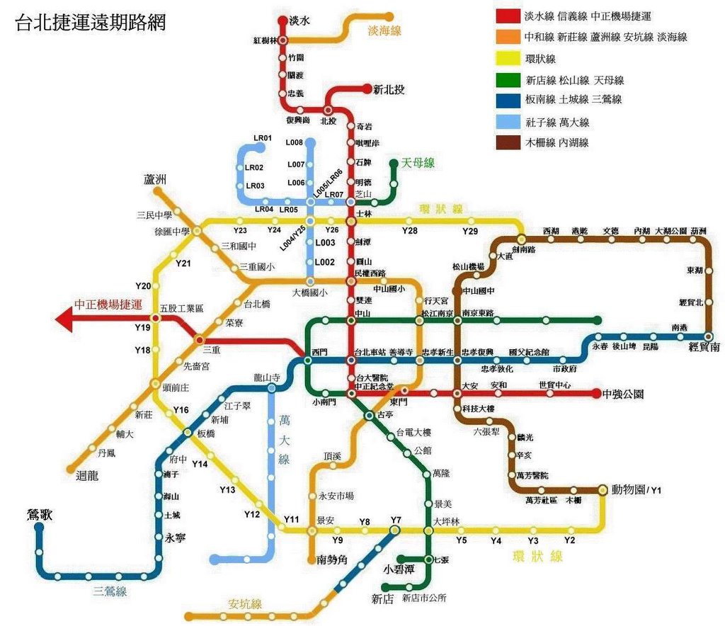
A friend sent me this, probably not classified information since I found more detailed information on Wikipedia, but I have no idea where he got it. It is the planned route for Taipei MRT after 民國100年 (Year 2011)
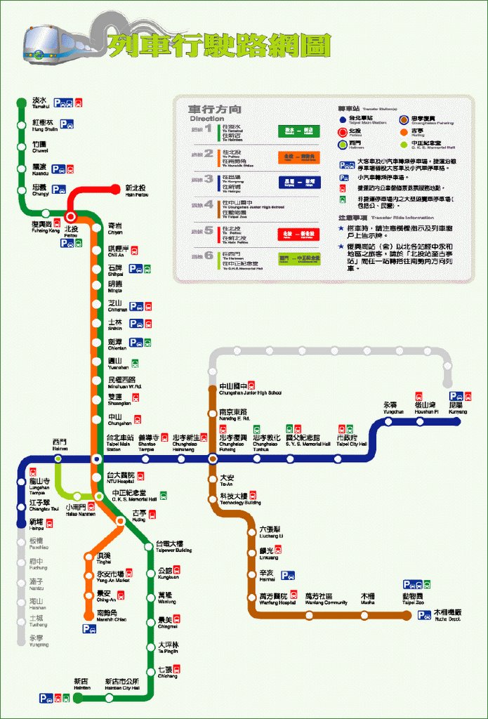
For comparison, below is the current Taipei MRT route as of 2005.
 My apartment is near 國父紀念館 Station on Blue Line and 世貿中心 (World Trade Center) Station on Red Line. The red line is not built yet, sometimes I walk 10 minutes from 國父紀念館 (Sun Yat-sen Memorial Hall) Station to get home for excerise. Other times I take the city bus that stops half a block from my house. In the future, 世貿中心 (World Trade Center) Station will be the nearest station to Taipei101, you would pop out the station right next to the tallest building in the world.
I treid to locate my apartment with Google Map and to better illustrate the new MRT construction, but my apartment is just beyond the mapped area. Google only mapped half the Taipei so far. Sigh.
*according to the Wikipedia MRT Route Map, there is one more station planned right before 世貿中心 (World Trade Center) Station. The station is between 安和 (Anhe Road) Station and 世貿中心 (World Trade Center) Station of the Red Line. That "un-named" station is on exactly my block corner ^_^
[Technology]
posted by Sushi Delight at
9:09 AM
![]()
![]()


0 Comments:
Post a Comment
<< Home